Monday, November 27, 2017

Thanksgiving at Cuyahoga National Park

-->

On Thanksgiving Day I found myself in the vicinity of Cleveland with a couple of hours to spare on my way to Pittsburgh for a family dinner. This was no coincidence. I have long wanted to explore Cuyahoga National Park, which is shoehorned into the densely populated region between Cleveland and Akron, OH. Talk about urban wilderness.

Ironically, since I-80 bisects the park, I have driven through it innumerable times on my way to and from the east coast. Until now, however, I have not taken the time to get off the interstate to see it. In other words, I have been as guilty as anyone of seeing the destination as more important than the journey. It was a great pleasure, even in this largely colorless season, to wander up and down the Cuyahoga River and get a taste for the lovely landscape.


Wikipedia has an entry for the term “urban wilderness.” However, the description of the “key traits” that constitute such a place could also describe any other kind of wilderness. It leans towards things like biodiversity, soil quality and an “unstructured aesthetic.” All important to the wilderness half of the equation, certainly. No mention, though, of the proximity or intrusion of a built environment.
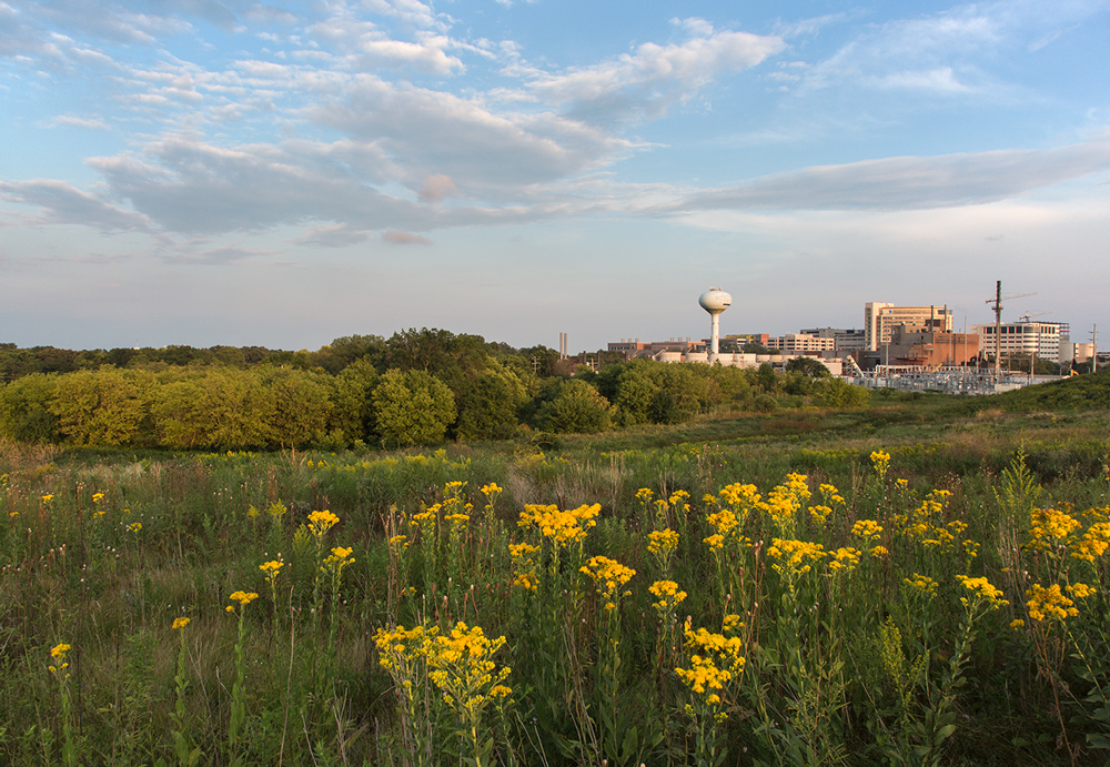
As you can see from my photo essay, the built environment is a major component of the Cuyahoga National Park experience—as I see it.

In fact, one of the highlights of my visit was walking across the Brecksville-Northfield High Level Bridge, which—as the name accurately suggests—provides panoramic and breathtaking views of the Cuyahoga Valley in both directions. It does, that is, if you bother to get out of the car. Unfortunately, that is not encouraged. I had to park some distance away and walk along the road to get to it. Although the bridge itself had adequate shoulders, there were no trails or sidewalks approaching it from either direction.

I learned that the reason for this curious omission was probably deliberate. After only a few minutes of peering over the edge with my camera, a police car pulled up next to me. The cop asked me if I was “just taking pictures.” I smiled and said yes, but must have given him a quizzical expression. He informed me that this bridge was favored by those with suicidal tendencies. I assured him that it hadn’t occurred to me and he drove off.

I had already been thankful for the beautiful day and the remarkable park set aside amidst such surroundings, but Thanksgiving suddenly took on another and more profound level of meaning.


Add caption
Brandywine Falls, a major attraction
Brandywine Falls overlook
I-271 overpass


Sunday, November 19, 2017

Horicon Marsh and the Niagara Escarpment


It was cold and blustery when I arrived at the marsh that day, but the first thing I saw was a huge flock of cranes idling on the edge of open water. I managed to squeeze off a few shots as they took flight. Within minutes they were all gone.


I had been invited to attend a meeting at the Horicon Marsh Education and Visitors Center, which is in the State Wildlife Area in the southern third of this vast marsh. Not to be confused with the National Wildlife Refuge, which makes up the northern two thirds. Did you know Horicon is the largest freshwater marsh in the country?


Speaking of largest, I've heard that we grow the largest muskrats in the country right here in the marsh, too. And in great abundance. I can't say whether this guy is fully grown or not. He/she slipped underwater shortly after I made the shot.


The mammoth is a kind of mascot for the Wildlife Area. Horicon Marsh was home to them before they went extinct 10,000 or so years ago. The cause may have been hunting or--get ready for it--climate change.


I was there for a meeting of a group called the Niagara Escarpment Resource Network (NERN). The Niagara Escarpment is a geologic feature that runs over 1,000 miles from Southeast Wisconsin through Ontario to New York. The Niagara Falls fall over it. This is a visible outcropping of the escarpment just east of Horicon Marsh on property recently acquired by the Milwaukee Audubon Society. During the Ice Age, two lobes of the continent-wide glacier split along the escarpment. On one side it scooped out Green Bay, Lake Winnebago and Horicon Marsh. On the other it scooped out Lake Michigan.


My NERN guides also took me to see this long-abandoned iron mine in a section of the escarpment nearby. It is owned by the University of Wisconsin--Milwaukee, which enables the DNR bat program to study the tens of thousands (give or take) of bats that hibernate inside over the winter.


Sunday, November 12, 2017

Chasing autumn in Milwaukee area parks


Noyes Park, Milwaukee
For many people, myself included, this is the best time of the year. But let’s face it. Autumn 2017 in Milwaukee has been disappointing. Blame climate change or natural variability but it was unusually mild early in the season. While that’s hard to complain about as the prospect of another Wisconsin winter nears, it seems to have dulled the colors. Many tree species, oaks in particular, seem to have gone directly from green to brown. Others have remained green far longer than normal. Some, like the maples, were finally turning as the calendar went from October to November.

Vernon Wildlife Area, Waukesha County

I finally found a few brilliant sparks amid the embers of the season but it was more challenging than last year. Here is a selection of five area parks that I visited recently. Two of them—Holy Hill and Greenfield Park—are old favorites, worth revisiting often. The other three were new to me: Glacier Hills in Washington County, Vernon Wildlife Area in Waukesha County, and Noyes in Milwaukee. If you act quickly, you too may still be able to capture a little of the fading glory of autumn.

This story was published in my column at Milwaukee Magazine. Click here to read further.

Here is just one of the photos from each of the five parks included in the story:

Glacier Hills County Park


Ice Age Trail at Holy Hill


Vernon Wildlife Area 


Greenfield Park


Noyes Park


 To see the rest, click here.


Saturday, November 4, 2017

Sanctuary Woods at the Milwaukee County Grounds gets national recognition


The Cultural Landscape Foundation lists the Wauwatosa property as threatened in its Landslide program


Sanctuary Woods in Wauwatosa has attracted a lot of attention over the past year as concerned citizens reacted to a controversial plan to develop portions of it. As of today, that attention has gone national for the first time. This morning The Cultural Landscape Foundation, a prestigious non-profit organization based in Washington DC, unveiled its annual call to action in support of important places it considers threatened. Following a rigorous application, jurying and vetting process, Milwaukee County’s Sanctuary Woods has been included among 13 at-risk landscapes from all over the country.


The mission of The Cultural Landscape Foundation (TCLF) is to connect people to places, to educate and engage the public “to make our shared landscape heritage more visible, identify its value, and empower its stewards.” One of the ways the foundation does this is through a program it calls Landslide: Open Season on Open Space, which draws attention to threatened places. The purposes of Landslide are to reveal the value of identified places, to highlight and monitor at-risk landscapes, and to save our heritage for future generations. This year Sanctuary Woods shares the Landslide spotlight with 12 other new entries that range from a tiny pocket park in Manhattan to the million-acre Boundary Waters Wilderness Area in Minnesota.


The Landslide designation recognizes that the southeast corner of the Milwaukee County Grounds, popularly known as Sanctuary Woods, is far more than a patch of woodland. Preservation advocates and development promoters alike have largely focused on its wildlife habitat and recreational value. As important as those things are, they do not tell the whole story. TCLF defines cultural landscapes as ones “that have been affected, influenced, or shaped by human involvement.” They can be repositories of cultural narratives and expressions of regional identity. Not only does Sanctuary Woods have a rich and compelling history, but fragments of that narrative are still evident in the landscape.

This story was first published at Milwaukee Magazine. Click here to continue