Showing posts with label greenway. Show all posts

Sunday, May 20, 2018

Jane's Walking in the Milwaukee River Greenway


Vince Bushell and I would like to thank the ten hardy souls who showed up despite the rain and gloom to take a Jane's Walk as part of the month-long celebration of the life and legacy of Jane Jacobs. Vince is Project Manager for the River Revitalization Foundation and our walk began at their headquarters on the bend in the river between Humboldt and North. 


The blustery conditions did not keep the small group from paying rapt attention as several of us provided information about the history of the Milwaukee River and development of the Greenway, the wildlife, the Arboretum, Urban Ecology Center and other sights along the way. Vince and I were helped along by Virginia Small, who is one of the Jane's Walk organizers, and Dennis Grzezinski, a board member of the Urban Ecology Center.


Our walk took us up the East Bank Trail to Riverside Park, where we discovered this spectacular display of wild bluebells. Then we crossed the Locust Street Bridge to Gordon Park and returned via the Beer Line Trail. By the time we finished the sun had finally peeked out, though it was a good thing everyone came prepared for the rain.

We had 32 registrations and it's clear from the flurry of emails and text messages I got this morning that the conditions kept most away. Understandable. Virginia, Vince and I discussed the possibility of scheduling another walk for those who couldn't make it. Stay tuned for that.


Tuesday, May 1, 2018

Jane’s Walk — The Milwaukee River Greenway: our premier urban wilderness


Picture yourself in a canoe, floating silently on a wide river in a valley flanked by tall wooded bluffs. You pass the occasional fisherman. Through the trees a lone jogger runs by on a riverside trail. A great blue heron starts up at your passing, rises on thermals, circles and soars away upstream. An idyllic vision.

View south from Locust Street
Now imagine being just minutes away from the towers of downtown. Welcome to the Milwaukee River Greenway, which, at over 840 acres, is larger than Central Park in New York. How many cities can you name where you might have an experience like this? One that approximates wilderness in the heart of a densely populated urban area.

I have been writing about Milwaukee’s “urban wilderness” for many years and I have numerous favorite places to go when I want to rejuvenate a spirit that longs for nature. But the Milwaukee River Greenway is among the jewels in the crown of an exemplary park system. It is our premier urban wilderness.

Rotary Centennial Arboretum
When I was invited to lead a walk for Jane’s Walk Milwaukee I immediately thought of sharing my love of this place. And so, I invite you to come experience the heart of the Milwaukee River Greenway, one of the greatest urban natural areas in the country.

If, like me, you are new to Jane’s Walk, I encourage you to check out the website and read up on Jane Jacobs, the author of The Death & Life of Great American Cities and the inspiration for this month-long citywide series of events.

I have recently embarked on a new project with Preserve Our Parks that will promote parks and encourage people to get out and explore them. We are calling it A Wealth of Nature to emphasize how fortunate we are to have an abundance of places to enjoy. I will introduce the group to the project and explain how you might use its features, which will include a new website that will help you find places to experience nature nearby.

For this tour I will be teaming up with Vince Bushell, who is Project Manager for the River Revitalization Foundation (RRF), Milwaukee's urban land trust. Vince knows a lot more than I do about the plants and animals we might see on our walk as well as the historic efforts by RRF and others to protect the Greenway.

Riverside Park
The details:

View north from North Avenue
Sunday, May 20 at 10 – 12 am.

The 2-mile tour will begin at the River Revitalization Foundation, 2134 N. Riverboat Rd., the former site of the North Ave. dam, and will end at the same location. There is street parking available.

From the Caesar's Park pedestrian bridge we will hike along the East Bank Trail north to Locust Street. This section of the tour is hard gravel and wheelchair accessible. After crossing the Locust Street Bridge we will walk back along the West Bank Trail, which is not accessible and may be muddy, depending on conditions. Points of interest include the Rotary Centennial Arboretum, Urban Ecology Center, Riverside Park and Gordon Park, with ruins from the period when it was a resort on the lake behind North Avenue dam. The views from Locust Street Bridge are a special highlight.

For more information and to register for the walk, go to our Facebook page. The tickets are free but there is a limit of 30 participants.


The ruins at Gordon Park

The walk is co-sponsored by Preserve Our Parks and River Revitalization Foundation.

View north from Locust Street
 To see more photos from the Milwaukee River Greenway go to my Flickr album.


Tuesday, January 16, 2018

Sierra Club plans to bring Nearby Nature to Milwaukee’s inner city


A program to generate interest in the outdoors dovetails with 30th Street Industrial Corridor redevelopment

When two members of the Great Waters Group, the local chapter of the Sierra Club, offered to take me on a hike along Lincoln Creek near 35th Street I didn’t quite know what to expect. But I never would have expected to see a great blue heron. It is December 23, officially winter. The heron would have been a surprise even in summer here in Milwaukee’s 30th Street Industrial Corridor. It certainly doesn’t belong here now! I watch it rise, circle slowly over the neighborhood like a protective spirit, then slide silently off to the northeast, following the watercourse.

The appearance of the heron, although surprising in itself, represents something truly revelatory: sufficient natural habitat to sustain it in this unlikely setting. West of 35th Street the formerly channelized Lincoln Creek runs straight and narrow between rows of neighborhood houses. It’s easy to imagine the concrete that once controlled the flow of water. But we walk east—and north, where the creek bends and the greenway, now decked in wintry shades of ochre and rust, widens.

The land slopes into a shallow valley. We thread our way through tall thickets of Japanese knotweed, beautiful but invasive. Stands of trees rise on either side of the stream. When they leaf out again in spring they might even hide from view the line of black tank cars that frames the eastern horizon. The ever-present railroad still defines the industrial corridor, even as the factories have disappeared, leaving behind brownfields and blight. 

This story was published in my column at Milwaukee Magazine. Click here to read further.


Thursday, December 14, 2017

Photo essay: Milwaukee River Greenway in white


Riverside Park
Another gloomy winter day made lovely by gently falling snow. The landscapes of the Greenway look faded, like sepia-toned etchings discovered in a disused trunk. The starkness of the season, paradoxically, increases the sense of wildness while simultaneously making it hard to ignore the urban in the urban wilderness.

Shelter 1, Riverside Park
 
Winter tapestry, Rotary Centennial Arboretum
 
Renegade cyclist, Riverside Park
 
Shelter 2, Riverside Park
 
Gordon and Riverside Parks from Locust Street Bridge
 
Riverside Pumping Station
 
Shelter 3, Cambridge Woods
 
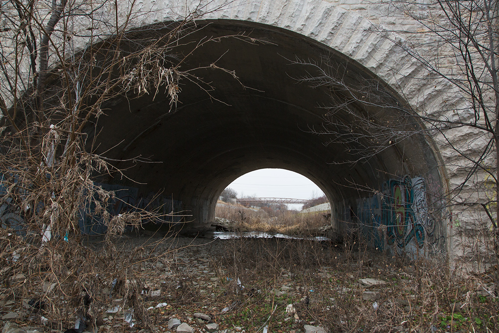
Tunnel to nowhere, Cambridge Woods
Bluff trail, Cambridge Woods
 
Grafitti, Cambridge Woods
 
The river, Cambridge Woods
 
Red sandstone cairn, Riverside Park


Sunday, August 27, 2017

Pleasant Valley: Milwaukee’s secret park


A once-bustling lake resort has returned to nature along the undammed Milwaukee River Greenway


An inviting but unmarked gravel path leads you downward toward the river. Descending into the forest canopy, dense foliage closes in around you. With each step the light grows dimmer, the sultry air cooler. At the end of the gravel a muddy trail parallels the riverbank. It vanishes in both directions into the dark forest. Standing here now, you would never guess that this once was the site of a popular resort that drew thousands of people on a warm summer weekend like this one.


Even the name might surprise you, if you were to consider a name at all. There are no signs identifying Pleasant Valley Park. There isn’t even much of a valley; just an overgrown ravine crossed by a mysterious and apparently purposeless pedestrian causeway. (It's an aqueduct, but I like the notion that you can't tell when you see it.) What there is—in abundance—is a wide variety of plant life of all shapes and sizes. On a hot day after a storm, it is more like a steamy and vaguely forbidding jungle than one of Milwaukee’s premier attractions.

That’s what it was for about 80 years beginning in the late 1840s. On the shore of the lake impounded by the North Avenue dam, the resort included a pier, bandshell, restaurant, rentable cottages, extensive landscaping and a grand beer garden. Torn down a century ago, no sign of it remains save a concrete curb along parts of the gravel path. Referring to the resort, a Milwaukee Journal article dated June 8, 1928 quoted a real estate broker as saying, “Few of the younger generation in the city realize that there is a spot in the heart of the city that has such beauty.”

What an intriguing statement that is after nearly 90 years! Who today knows anything about Pleasant Valley Park? And yet many of those who do—including significant numbers of the current younger generation—recognize the beauty that is here, hidden in plain sight. 

This story was published at Milwaukee Magazine. Click here to continue reading

Sunday, April 23, 2017

Annual Earth Day river clean up

Yesterday was a most beautiful day for a river clean up. If the few sites I managed to get to were an indicator of participation then we had a great turn out for it, too. The clean up is sponsored by Milwaukee Riverkeeper and there were many sites along all of our rivers. I stuck to the Milwaukee River. Started at Lincoln Park and made my way downstream to Caesar's Pool, although by the time I got to the end it was indeed the end and the volunteer staffers were heading off to the after party at Estabrook Park. Here are are few of my photos. More can be seen on Flickr.

Members of girl scout troop 20055 lend each other a helping hand. Lincoln Park.

Lincoln Park


Lincoln Park


Lincoln Park


Estabrook Dam


Members of Chinmaya Bala Vihar Hindu community at Estabrook Park


Estabrook Park


This chalkboard has to be the catch of the day! Hubbard Park.


Bicycle cop on the West Bank Trail at North Avenue.


Wrapping up for the day at Caesar's Pool.


See the complete Earth Day river clean up album on Flickr.

Monday, April 10, 2017

A beautiful, brief spring weekend in Wisconsin

Little Menomonee River Parkway

As I post this photo essay the weather has suddenly turned cold and nasty again. Yes, it's still that kind of spring. But you would be forgiven if over the past weekend you thought we'd skip that and go straight to being nice and warm, sun shining and flowers blooming. Because it was, if only briefly.

Little Menomonee River Parkway
My weekend began at dawn (top) in one of my favorite places along the Menomonee River Parkway, near where it ends at the county line. I went looking for migrating geese, which I've found there in abundance in the past. No luck with that this time. But the dawn itself was worth the time.

Little Menomonee River Parkway
Later, I explored the Donges Bay Gorge Natural Area, which was new to me. I never would have found it on my own, either. I came across it on the Ozaukee Washington Land Trust website and I stopped to check it out on my way to an event at the Lynden Sculpture Garden, which is nearby.

Donges Bay Gorge Natural Area

It's not only hard to find without a map or directions, but when I got there I discovered that they don't expect a crowd. The dirt parking lot has room for only three cars.

Donges Bay Gorge Natural Area
 It also isn't a very large natural area. The trail, called "Wendy's Trail" for reasons that are not revealed on the signage, runs along the rim of the "gorge," which is similar to many of the other ravines that can be found all along the shores of Lake Michigan. Wendy didn't like to hike down into the ravine, apparently, for the trail doesn't go there. After a short walk I reached the bluff overlooking the lake, where Wendy sits down on one of two benches provided for her.

Donges Bay Gorge Natural Area
It was lovely, though. The scent of pine and solitude, along with surprisingly warm sunshine, were reason enough to go there.

On Sunday, I returned to another of my favorite urban wilderness haunts, the Milwaukee River Greenway.

West Bank Trail, Milwaukee River Greenway
 The scenery is still largely devoid of leaves...

West Bank Trail, Milwaukee River Greenway


 ...but they're on the way.

Bank stabilization, Pleasant Valley Park, Milwaukee River Greenway

The Milwaukee River Greenway is a series of mostly named public parks, although some of the names are unfamiliar to all but the initiated. Take this one, Pleasant Valley Park, aka Blatz Park. Its "valley" is another one of those ravines, only this one leads to the river instead of the lake. When the river was in fact a lake, backed up behind the North Avenue dam, this park was an exotic resort. Steam boats pulled up at a dock here and crowds of passengers poured out to partake of its beer garden. You would never imagine this if you go there now. (Read all about "the forgotten Milwaukee River park" in Milwaukee Notebook.)

Causeway to nowhere, Pleasant Valley Park, Milwaukee River Greenway

Until recently, when the steep slope of one side of the "valley" was denuded of trees in order to save it, the most notable and quirkiest thing about this ravine was the pedestrian causeway that crosses it for no discernible reason. Now, the view from the causeway of the bank stabilization effort draws one's attention, as would a person who had shaved one half of his head and left the other in a tangled mat of unkempt hair. "But it will grow back" is probably the polite thing to say.

West Bank Trail, Milwaukee River Greenway
What I can't figure out here is whether or not the beaver was in on the joke or if the joke was on the beaver. I'm trying to imagine the moment when the beaver had just gotten far enough through the trunk that the remaining fibers started to tear apart. How far, I wonder, does a beaver back off at that point? It couldn't possibly have guessed that, instead of crashing straight down over the edge of the river, as it normally would, the whole tree would suddenly catch in the crook of another tree and spring up like a mouse trap. I had to ask myself, did the beaver lose a tooth? Or its head!

West Bank Trail, Milwaukee River Greenway
I hope you enjoyed your weekend as much as I did. And may spring return soon!

To see more photos of the Milwaukee River Greenway, go to my Flickr album.